
Drone by Drone performs crops monitoring from the air by drones. This technique, also known as precision agriculture, allows to localice the management for each plot of land, paying particular attention to those areas most in demand.
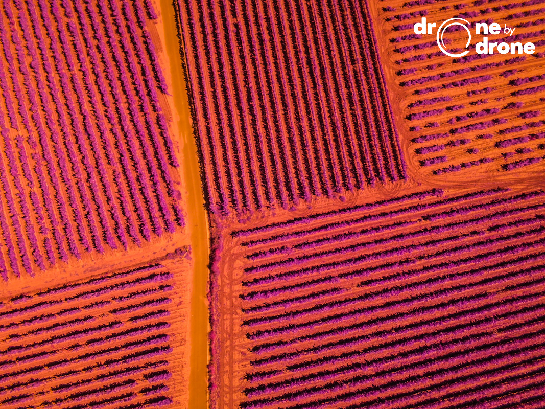
Drones are equipped with sensors that are able to capture the infrared spectrum of plants. Using data collected by the sensors, custom reflectance maps for each crop and for each variable study are made.
Precision Agriculture allows to know different areas of the surface of the culture and not treating all of it evenly. By drawing spectral reflectance maps can be determined localized problems before they affect the entire crop.
One of the main indices used is the NDVI, which measures the degree of strength of the plant or chlorophyllic performance and which can break off many conclusions about the health of it. Once the reflectance map of the NDVI index is generated, the analysis can determine crop areas that should be monitored more carefully allowing more accurate decision making.
By optimizing resources, applying them exactly where they are needed, the following objectives are achieved:
- The needs are adjusted to each crop plant.
- The impact associated with agricultural activity is reduced to save resources.
- Yield increases and improvements in competitiveness are obtained.
All this thanks to the data provided by sensors that Drone by Drone puts in flight. A clear example is the photograph illustrating the header of the news. A photograph taken by a NIR camera in the near infrared spectrum.