
Drone by Drone has recently moved to Portugal to conduct an assessment of pasture by drones for the important cattle sector near Evora.
Drone by Drone has flown over many hectares of pasture by our drones, both fixed wing and multicopters in many farms in the Alentejo portuguese region.
Result of work done by drones and data obtained by the used sensors, is intended to improve the quality of pasture for cattle to optimize pasture rotation between different parcels to avoid depletion of these.
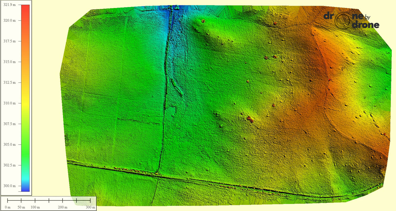
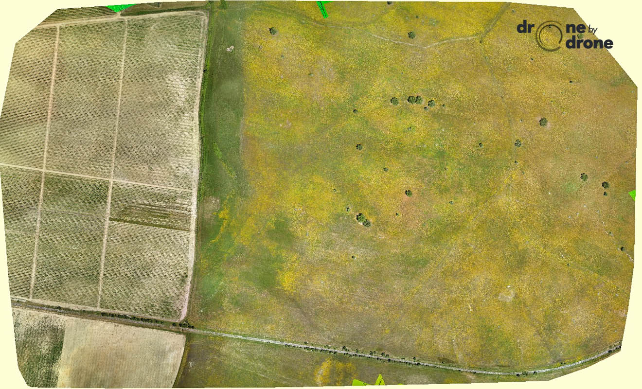
One example is the farm shown in the attached orthophotos. It is a farm of about 85ha with some unevenness and presence of scattered woods. By photogrammetry has been obtained accurate orthophoto to establish the precise boundaries of the plot and a digital terrain model with elevations, where it can be seen uneven and less productive areas. The models has been generated by 175 high-quality aerial photos obtained by RPAS.
Thanks to our precise tools such as Sensefly eBee, work could be done efficiently and quickly, despite the extension of the many farms that were monitored.