
Photogrammetry by drones allows the generation of accurate digital terrain models (DTM) and surface (DSM).
The vast amount of data collected by the drones is processed by professional photogrammetryc software for obtaining digital models to exploit using GIS tools.
Drone by Drone counts among its fleet with specialized drones in photogrammetry jobs, such as Sensefly eBee fixed wing, which can fly throught over large areas to acquire accurate aerial images. Once you obtained the images, both perpendicular as the oblique in case of using multicopters, are processed by our technical staff. The processed data are delivered to the customer in various formats to use in CAD and GIS tools such as Autocad, ArcGIS, QGIS or Global Mapper.
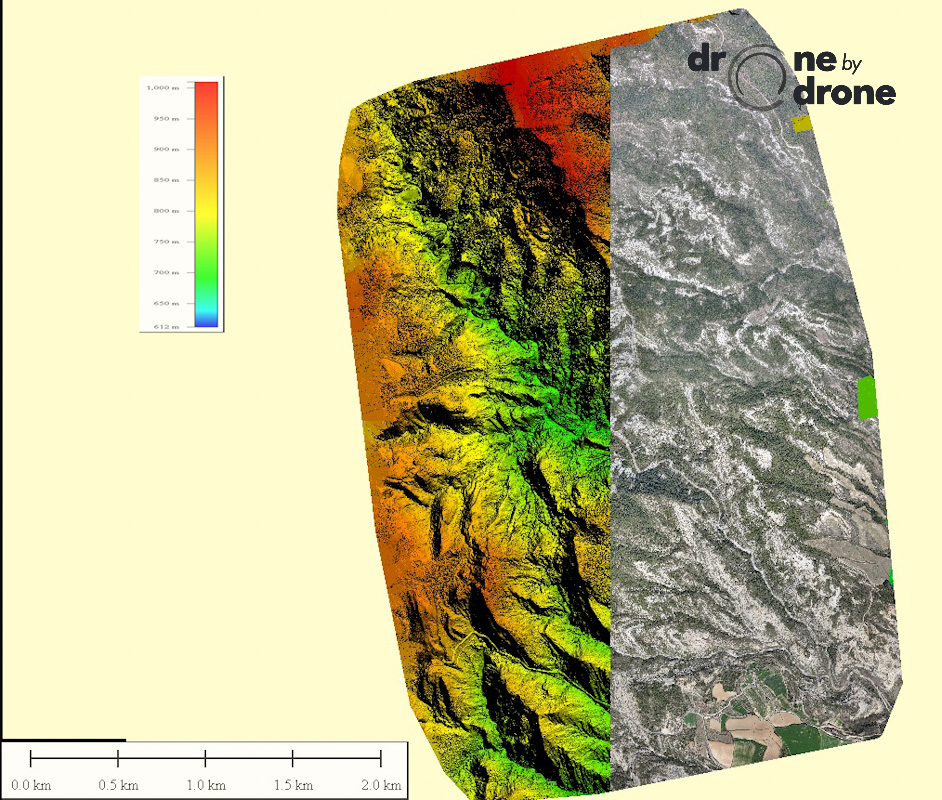
The documents that are generated are outputs corresponding to the point cloud generated, 3D Mesh, the Orthophoto and DTM.
An example of the export of data generated, can be seen in the accompanying photographs, in which both the DSM indicating elevations and the orthomosaic are represented by color scale, with a resolution of 5 cm / pixel .
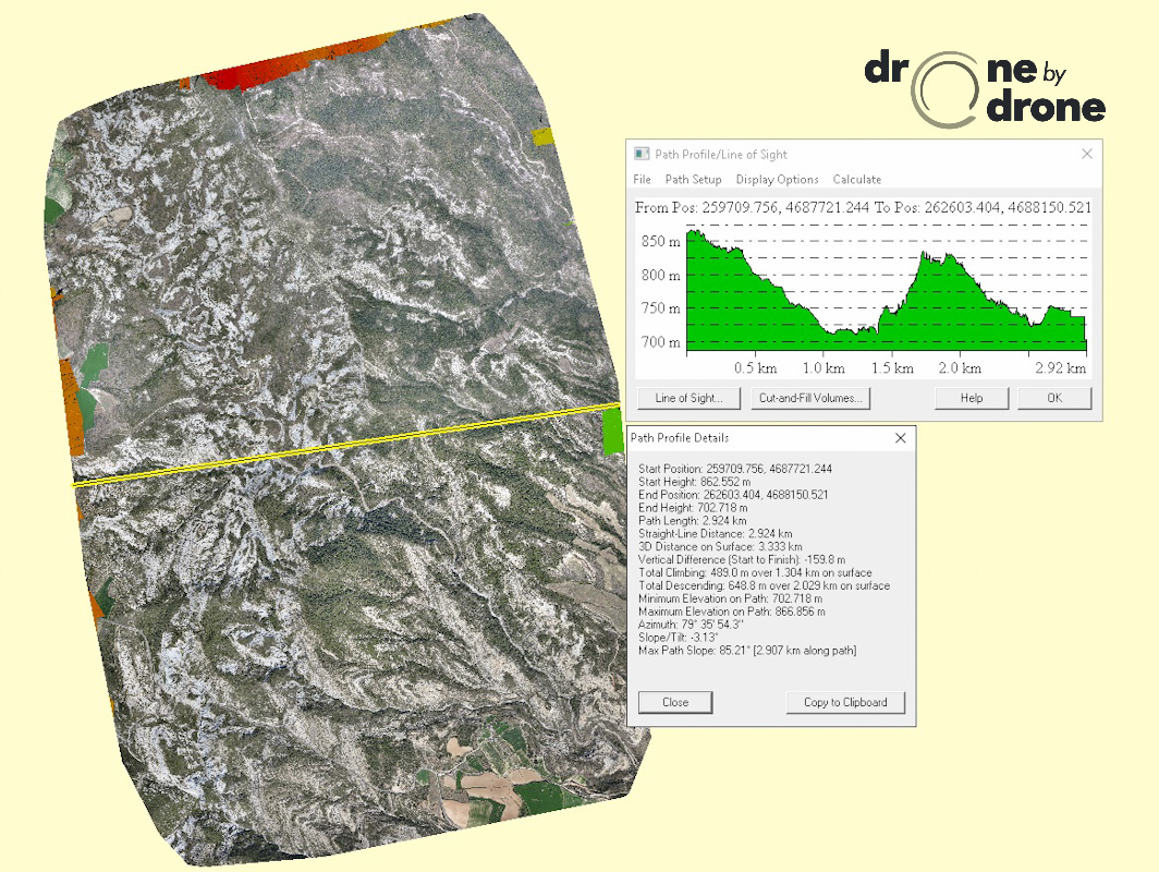
Furthermore, with the aforementioned CAD and GIS tools you can obtain terrain profiles, volumes, surfaces, movements in the event of landslides...
The versatility and potential use of drones in this field is infinite.