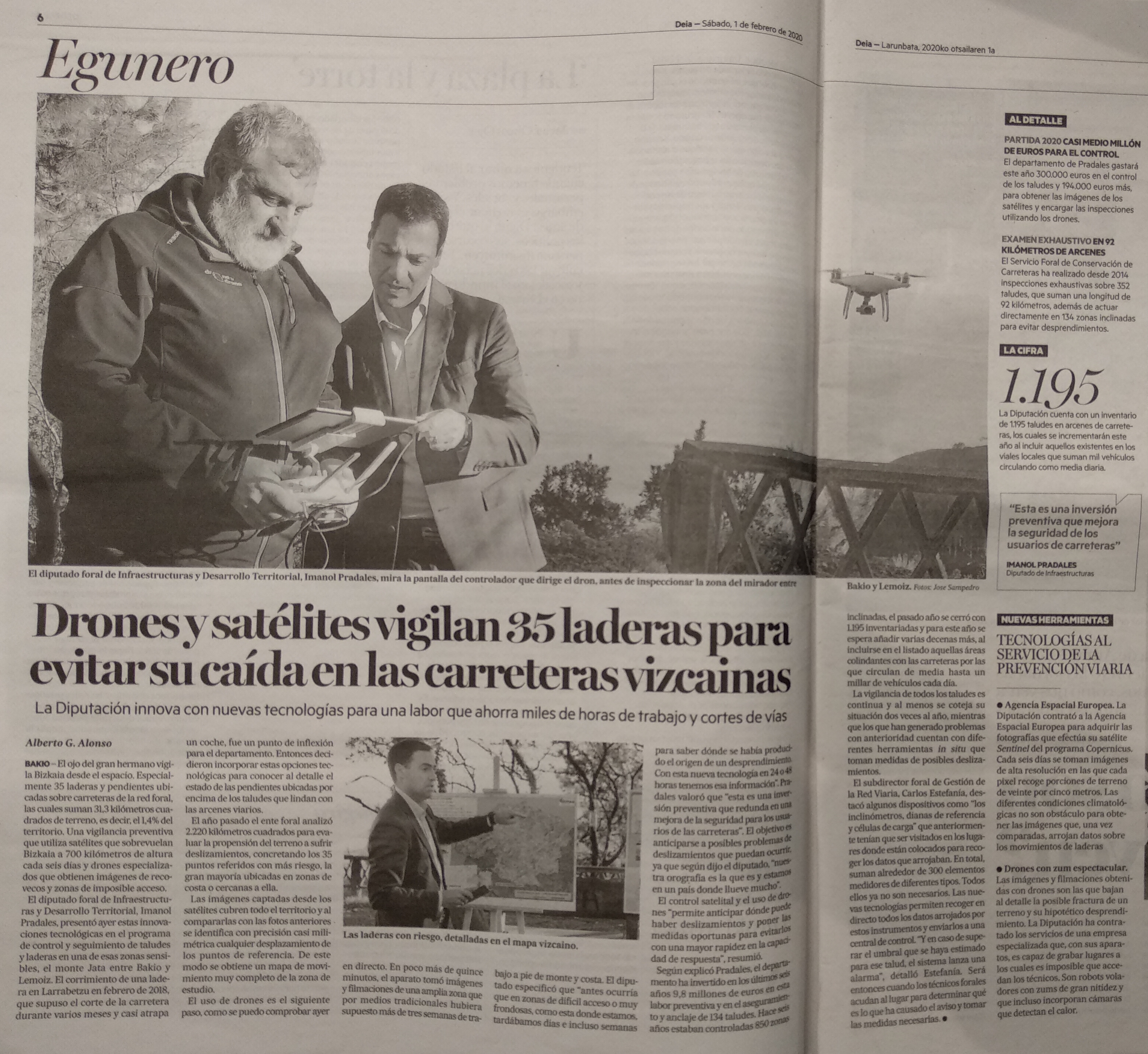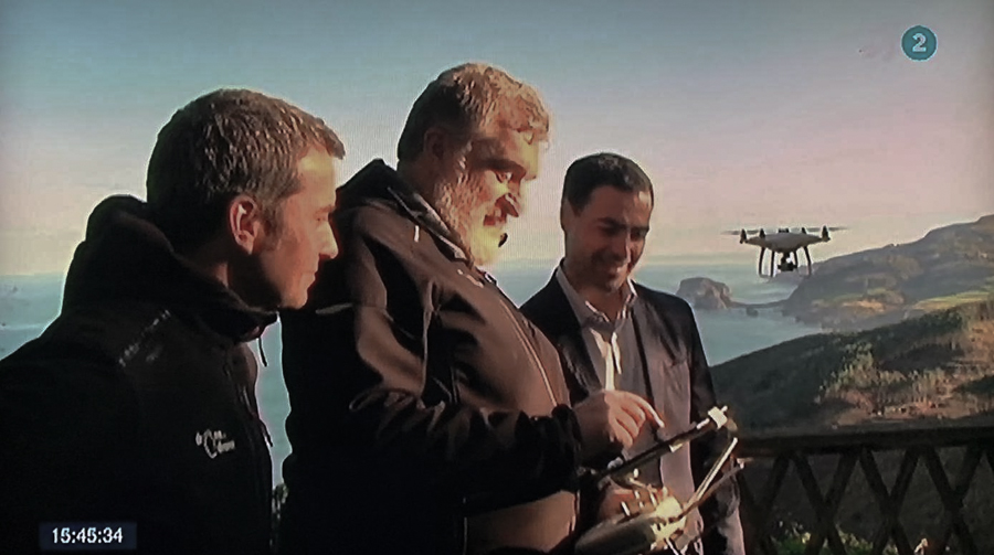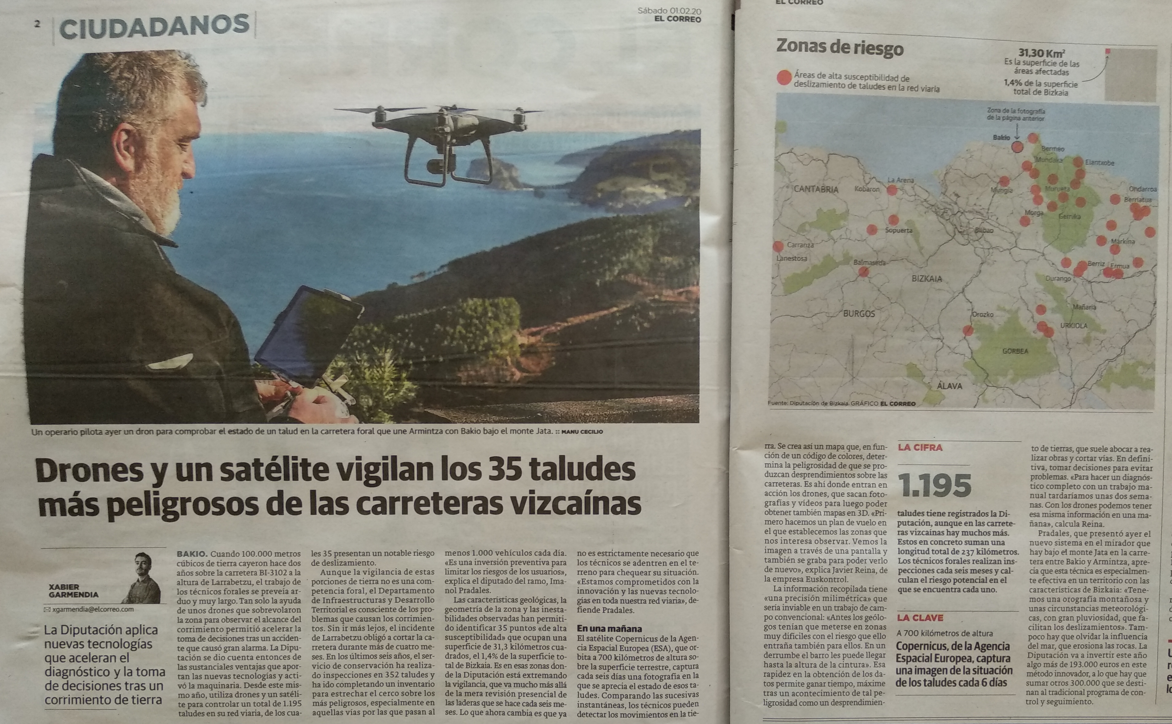

The Provincial Council of Bizkaia introduces control with drones and satellites to monitor slopes and slopes on the roads of Bizkaia
The control and monitoring of slopes and slopes allows to act to minimize the risk of landslides that affect road safety, and between 2014 and 2019 the Department of Infrastructure and Territorial Development has invested 9.8 million euros in actions to control of slopes. A regional inventory collects detailed information on 1,195 slopes that add a length of 237 kilometers. The Road Conservation Service has incorporated the use of satellite images and drones to monitor the sliding of hillsides that may affect the road network. This surveillance focuses on 35 areas that total 31.3 square kilometers and have a high susceptibility to landslide.
In addition to the investigation based on satellite images, the Provincial Council incorporates the use of drones, with which to obtain high-resolution photographs and aerial footage, as well as orthophotographs, photogrammetries and 3D terrain modeling. With multispectral images you can obtain cartographies of different parameters associated with geology, geomorphology, soil uses, degree of humidity, presence of water or the state of vegetation.
Thus, the use of drones in the control of slopes allows to obtain relevant information in a very short period of time and in areas of difficult access. As main drawbacks, drones are sensitive to weather conditions, and current regulations reduce the possibilities of use to areas of uncontrolled airspace and outside population centers.
This is what the written press and the information services of ETB last Saturday.
https://www.eitb.eus/es/noticias/sociedad/detalle/6999227/bizkaia-controla-drones-satelites-237-kilometros-taludes-carretera/