

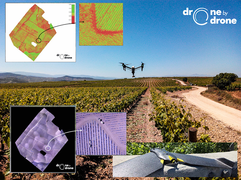
Thanks to Sensefly eBee Ag, a drone specialized for agriculture, Drone By Drone obtains aerial data by using cameras of different types: spectrum visible, infrared, thermal, etc.
There are countless applications for agriculture and farming, thus, drones have become an essential tool for Precision Agriculture since they offer extraordinary surveillance and provide lots of other useful data too.
In Drone by Drone we offer the following professional services:
- A Damages and Disasters expert’s report.
- Reflectance map preparing.
- Making of spectrum maps for agriculture indexes such as the NDVI.
- Irrigation control for water management.
- Assessment by means of multi-spectrum cameras.
- Pest surveying and control.
- Boundary detection and reshaping.
Drones for the agriculture and cattle industry
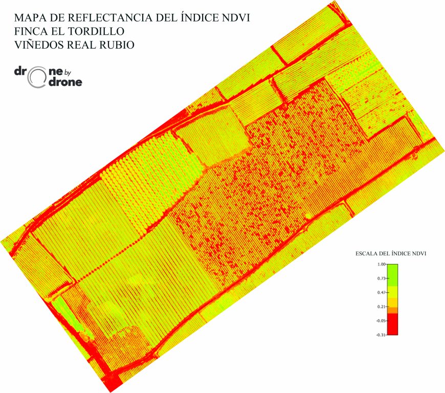
NDVI index reflectance map in vineyard
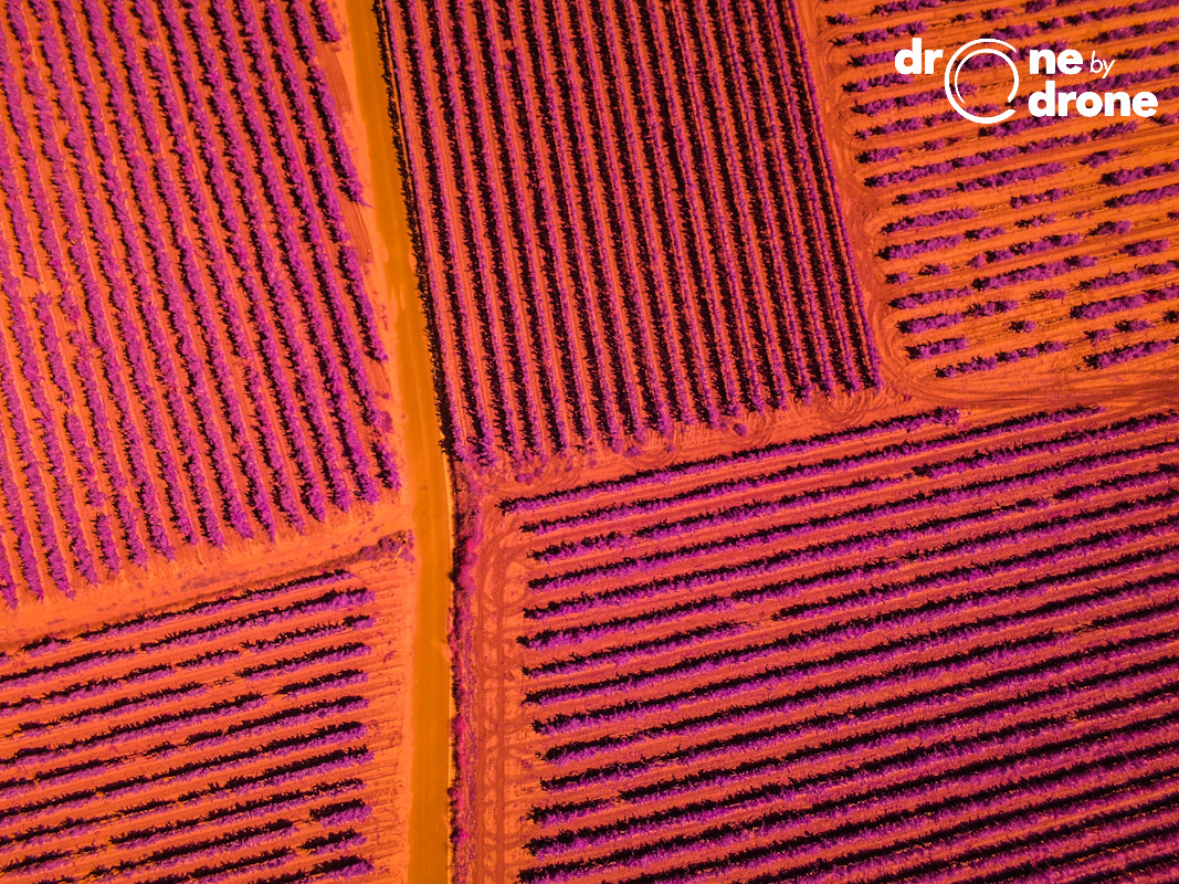
Near infrared (NIR) spectrum photography for water stress evaluation