
Within the #EKIN_klima initiative of the EITB information services to make the importance of climate change visible, Drone by Drone has taken aerial images using drones or UAS in coastal municipalities that could potentially be affected.
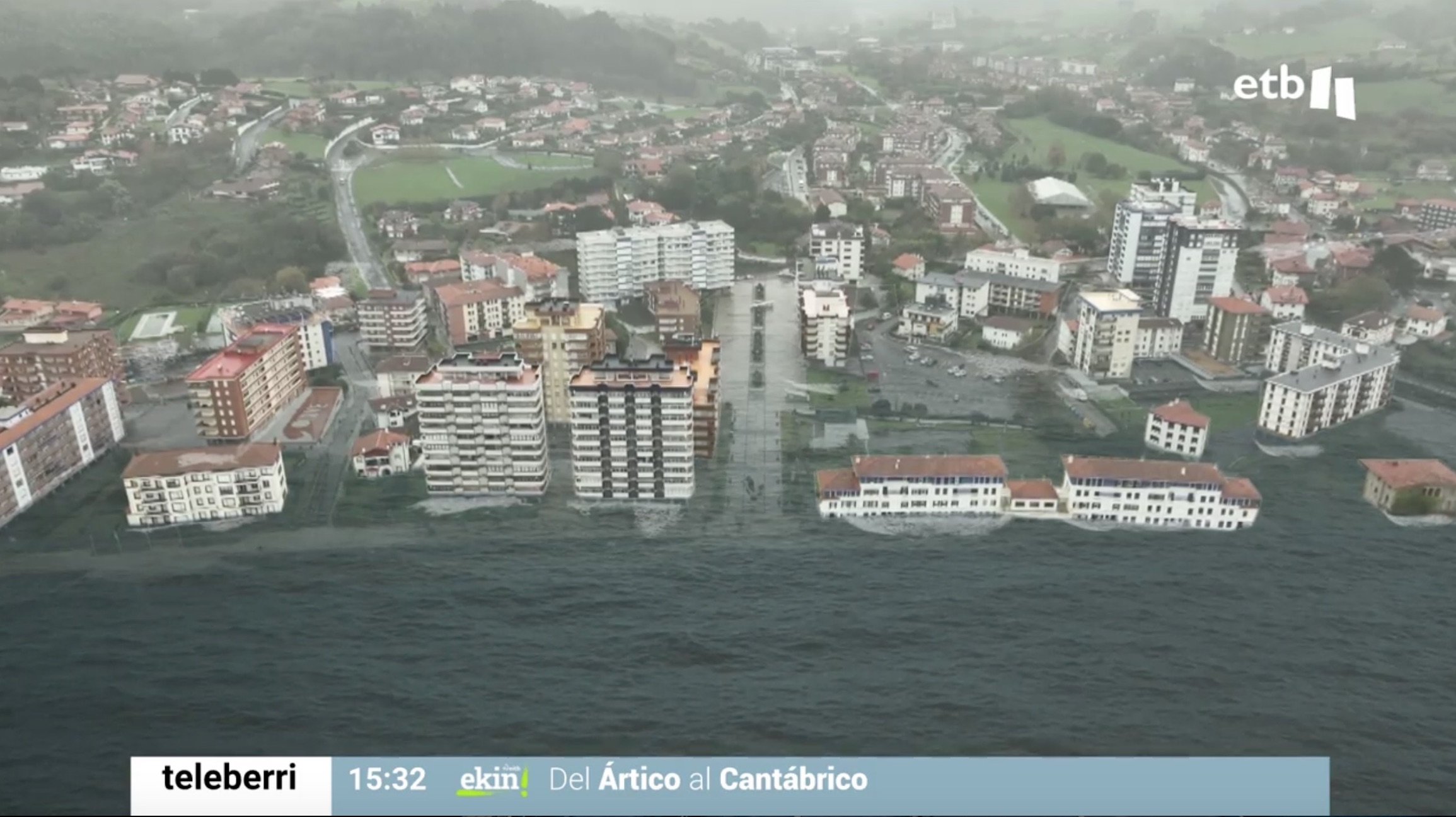
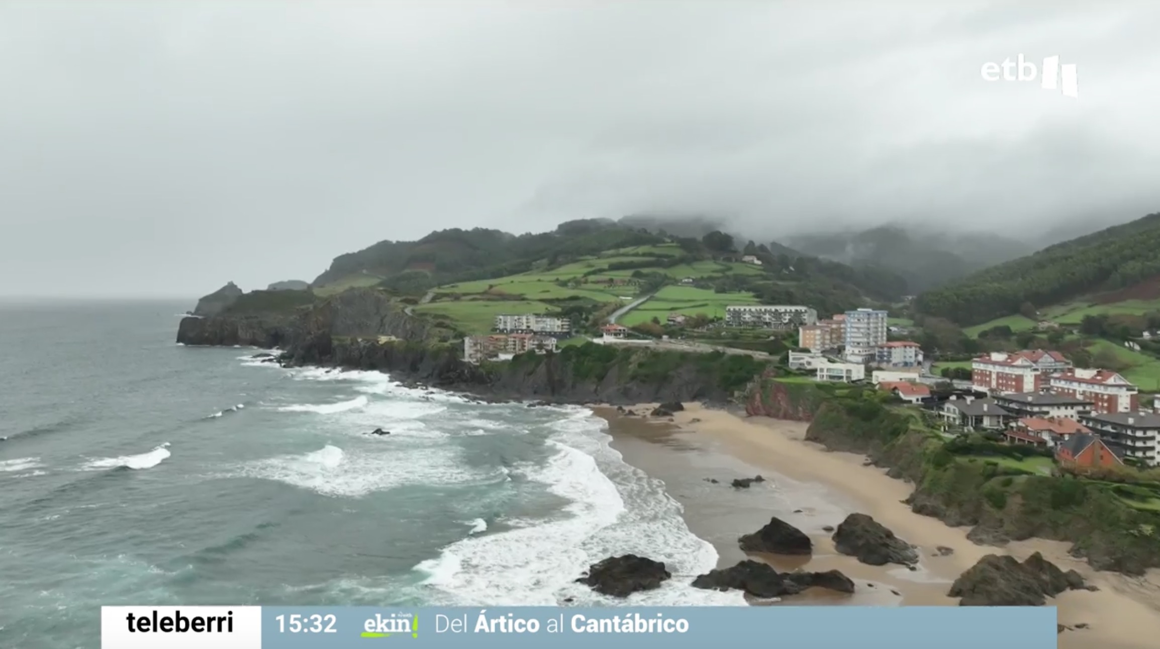
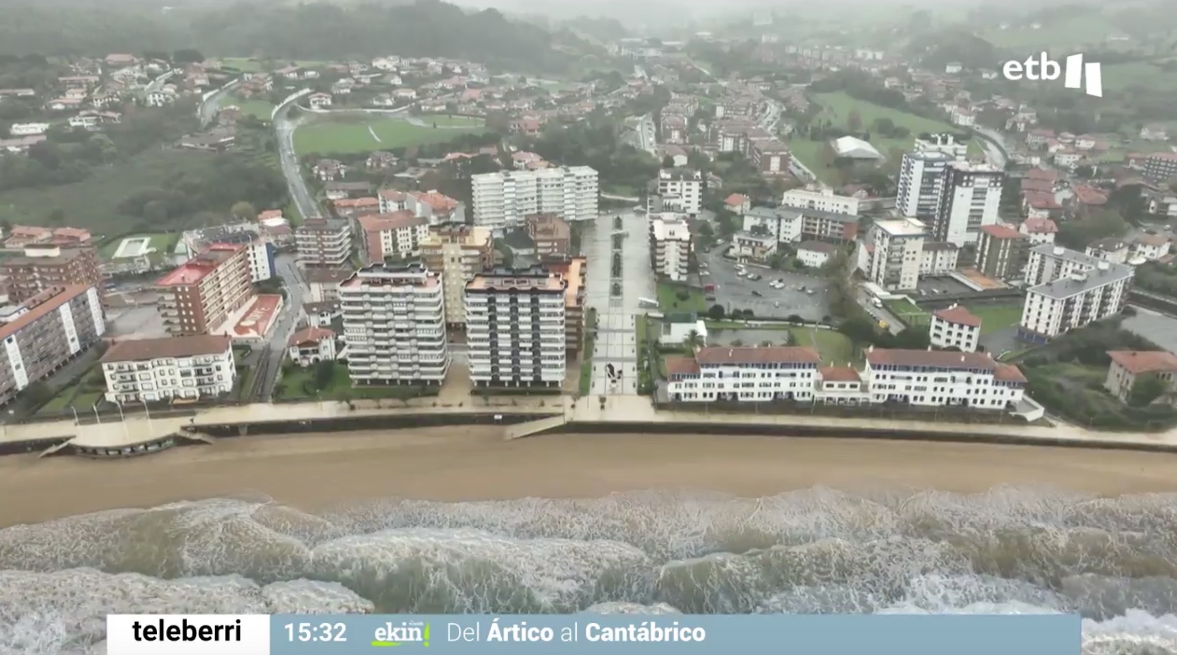
In the ETB Teleberri on November 30, images recorded by our drones in the town of Bakio were broadcast to illustrate the danger that the rise in sea level would pose, with the gradual disappearance of the sandbanks, even with the possibility that occasionally In the face of storms and adverse weather phenomena, water destroys inhabited areas and damages land infrastructure.
The aerial images include digital recreations of the extent of these sea avenues, thanks to the data provided by AZTI, which has been studying this phenomenon since the 1980s.
The greatest risk of flooding will be one of the main effects of climate change on the Cantabrian coast and drones are fundamental tools to capture aerial data, not only audiovisual, but also topographical to be able to study the leveling of the terrain and be able to project solutions to future, in which flood zones are avoided or short-term solutions are proposed.
You can view the images at the following link:
https://www.eitb.eus/es/noticias/sociedad/videos/detalle/9367390/video-adaptacion-de-localidades-costeras-y-descarbonizacion-de-pesqueros-dos-retos-ante-cambio-climat/